AVAILABLE 24x7
888.662.2724
AVAILABLE 24x7
(888) 66CARAH
Fast & Accurate
Request A Quote
Quick Response
Chat With Us

Carahsoft, in conjunction with its vendor partners, sponsors hundreds of events each year, ranging from webcasts and tradeshows to executive roundtables and technology forums.
Events and Resources
Events
Upcoming Events
Akamai Virtual Event
Event Date: May 14, 2026
Hosted By: Akamai, FedInsider & Carahsoft
CPE credit available
Hosted By: Akamai, FedInsider & Carahsoft
CPE credit available
The National Association of State CIOs announced in December 2025 that a new priority has taken the top spot in its annual survey of issues concerning state CIOs across the country – artificial intelligence (AI), bumping cybersecurity to the second spot for the first time in a dozen years. But the connection ...
Email Campaigns
Event Date: May 18, 2026 - May 19, 2026
Hosted By: Carahsoft
Location: San Jose, CA
Hosted By: Carahsoft
Location: San Jose, CA
Will you be attending
Forescout Virtual Event
Event Date: May 20, 2026
Hosted By: Forescout & Carahsoft
Hosted By: Forescout & Carahsoft
The attack surface and threat landscape for critical infrastructure organizations is expanding faster than ever. Forescout Research - Vedere Labs recently released findings that reveal a rapidly shifting risk landscape. It's vital that your organization is prepared when it comes to cyber ...
Multi-Vendor Onsite Event
Event Date: June 16, 2026
Hosted By: Versa, ThunderCat Technology & Carahsoft
CPE credit available
Location: San Diego, CA
Hosted By: Versa, ThunderCat Technology & Carahsoft
CPE credit available
Location: San Diego, CA
In an era where the network is the new battlefield, "good enough" security is a liability your mission can’t afford. As the Department of the Navy modernizes to meet sophisticated cyber threats, moving toward ...
Archived Events
Multi-Vendor Virtual Event
Event Date: April 23, 2026
Hosted By: Armis, Fortinet & Carahsoft
Hosted By: Armis, Fortinet & Carahsoft
State and local Government agencies are facing a rapidly expanding attack surface, fueled by the growing number of unmanaged and hard-to-inventory assets across IT, OT, IoT cloud and remote environments ...
Forescout Virtual Event
Event Date: February 26, 2026 - April 07, 2026
Hosted By: Forescout, DataOculus & Carahsoft
Hosted By: Forescout, DataOculus & Carahsoft
The quantum clock is ticking and adversaries aren't waiting.
Join us for an essential session on quantum risk and post-quantum cryptography (PQC), where we'll cut through the complexity and show you exactly what's at stake and what to do about ...
Multi-Vendor Virtual Event
Event Date: March 11, 2026
Hosted By: Dynatrace, ServiceNow & Carahsoft
Hosted By: Dynatrace, ServiceNow & Carahsoft
Citizens and missions depend on reliable digital services, and public sector IT teams are expected to deliver them with limited resources, aging systems and strict compliance requirements.
Dynatrace and ServiceNow hosted an exclusive webinar where they revealed how their integration is redefining IT service ...
Multi-Vendor Virtual Event
Event Date: February 26, 2026
Hosted By: Armis & Carahsoft
Hosted By: Armis & Carahsoft
In the rush to modernize state and local infrastructure, many agencies have fallen into the “collection trap,” accumulating a massive stack of security and management tools without a proportional increase in safety. When your team spends 80% of its time managing dashboards rather ...

Virtual Event
Event Date: February 25, 2026
Hosted By: Arista Networks & Carahsoft
Hosted By: Arista Networks & Carahsoft
In this on-demand webinar, Arista Networks experts share insights on leveraging cloud networking solutions to meet mission-critical demands. Discover how agencies are modernizing their infrastructure with Arista's advanced automation, visibility and secure capabilities. Watch now to learn best practices and proven ...
Nozomi Networks Virtual Event
Event Date: January 22, 2026
Hosted By: Nozomi Networks & Carahsoft
Hosted By: Nozomi Networks & Carahsoft
Airports are some of the most complex and interconnected environments in the world — blending IT, OT, and IoT systems across everything from baggage handling and lighting, to fueling and passenger operations. As these systems become more connected, the risk of cyber disruption grows. A single OT outage can ground ...
Resources
Featured
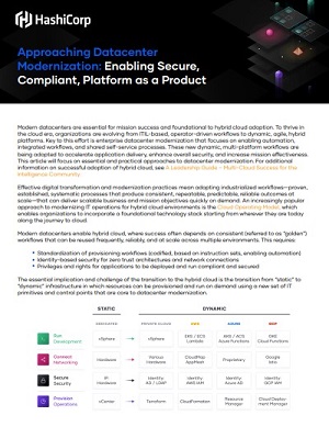
In this article, learn about the Modernization of Datacenters. Why it is important and why HashiCorp is on the cutting edge of helping businesses achieve this milestone.

ActiveState has evolved its long-standing expertise in open-source security to address the growing challenge of vulnerabilities in cloud-native container deployments. Recognizing the need for a quick solution for vulnerable container images, ActiveState is excited to introduce Secure Containers. The...

The Department of Defense has been a source of remarkable innovations. Despite that reputation, the United States Space Force (USSF) struggled to adapt workflows to their evolving mission while relying on legacy systems. In this Atlassian case study, learn how the USSF used DevSecOps-compliant softw...

Disconnected communications and systems delay projects, stifle accountability and foster frustration. These issues only multiply as agencies grow. In this case study, learn how the National Security Service (NSA) united teams using Atlassian’s powerful technology suite, ensuring consistent, sc...
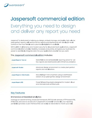
This datasheet provides an overview of Jaspersoft commercial edition. You can read about the key features and the additional benefits of using Jaspersoft commercial edition.
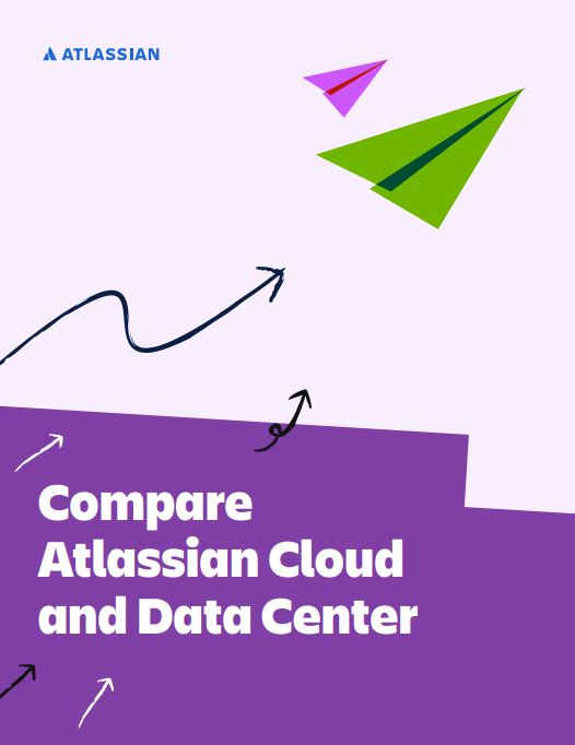
Atlassian Cloud and Data Center are powerful options for agencies looking to transform and modernize how they work, but their benefits and capabilities are not entirely the same. Access this datasheet to learn about the nuances of Atlassian Cloud versus Atlassian Data Center to discover which will s...
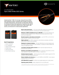
The Seagate Nytro 5060 NVMe SSD series sets a new benchmark for high-performance storage with PCIe Gen5 technology, achieving blistering speeds of up to 14.9GB/s bandwidth and 3.3M IOPS. As the only enterprise NVMe drives with NSA CSfC certification, they deliver unrivaled data security for classifi...
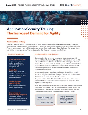
Things are changing quickly in the cybersecurity world and new threats emerge everyday. Agility is key. You need to be able to move faster with confidence.

Aqua’s Cloud Native Application Protection Platform (CNAPP) protects your cloud native applications with a single, unified solution throughout their entire lifecycle. Unifying key security capabilities, CNAPP can protect against both known and unknown threads using a combination of shift-left ...
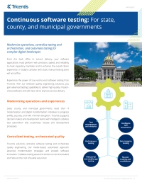
Tricentis provides a robust platform for software testing and quality engineering, purpose-built for public sector organizations addressing complex digital demands. Its codeless automation capabilities streamline testing workflows, reduce dependency on manual processes, and enable faster, more relia...