Years ago, as I waited at a traffic light, I wondered why infrastructure maintenance still leaned so heavily on manual inspections and reporting. That question sparked an idea: What if roads could tell us when something was wrong?
Today, that vision has become a reality. Dashcam imagery—passively captured from vehicles already on the road—is now powering automated AI models that detect issues like fading lane paint, damaged signs, and debris. Looking ahead, the integration of expansive imagery sources, such as Google Street View, promises to further enhance this capability, offering broader and more detailed coverage. It’s a shift from scheduled inspections to constant awareness, from sending crews out to bringing insight in.
Automation with Real Impact
Traditional inspections are resource intensive. They usually involve deploying extra staff and specialized equipment, and scheduling work during off-hours to avoid disrupting traffic. AI-driven visual intelligence of dashcam footage can reduce the number of manual surveys required by more than 90%, saving considerable time and money.
Take Fort Worth. Dashcam imagery gave the city a fresh look at lane striping and sign visibility, but from the driver’s perspective, not an aerial map. It’s how people experience the road daily, and it’s the same view automated vehicles rely on to safely navigate.
Instead of waiting months for a full inspection cycle, cities can spot and act on issues within days. Enabling faster response and more strategic use of limited resources.
Smarter Operations. Less Fieldwork.
While field checks are still common for most agencies, the model is shifting. With dashcam footage collected by vehicles already in motion and analyzed automatically, teams can now monitor more of the network without constantly dispatching field crews.
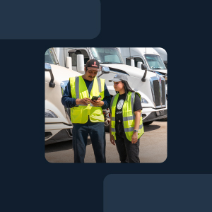
In Alaska, for example, dashcam data is used to monitor remote routes that are difficult and sometimes dangerous for crews to inspect in person. This kind of visibility can be a game changer for regions with tough geography or tight budgets.
Instead of following a fixed schedule or responding to complaints, agencies can now rely on AI-driven alerts to flag when conditions change. It’s a shift from routine patrols to focused action, and it means fewer trips to the field, less fuel, and better outcomes with the same (or smaller) team.
Compliance without the Complexity

Staying compliant with FHWA, MUTCD, and other federal standards typically requires a lot of paperwork. However, with AI-based monitoring, those checks can happen automatically in the background. Retroreflectivity, sign placement, and line clarity are continuously reviewed and documented.
Each data point is visual, time-stamped, and ready for audits, grant applications, or internal reviews. Even better, it’s easy to share. Operations, maintenance, and planning teams can stay aligned without sifting through emails or outdated spreadsheets.
A New Model for Infrastructure
The future of road operations isn’t about more inspections. It’s about smarter ones. Or, in many cases, none at all. When roads can essentially report their condition using dashcam footage and AI, agencies don’t have to guess or wait. They already know what’s happening.
And this is only the beginning. As capabilities such as historical imagery access and visual change detection over time emerge with Google Street View and become integrated, transportation teams will gain even deeper insight into how their infrastructure evolves. These images will empower agencies to identify long-term patterns, track degradation over time, and intervene before minor issues escalate into costly repairs.
For public teams expected to cover more ground with fewer resources, this isn’t just about saving time. It’s about working in a more intelligent, sustainable way, built for the demands of today’s infrastructure and ready for tomorrow’s.


